Download and use these maps to help show you the way around the Black Hills and Badlands of South Dakota. They are the definitive visitor maps for the Black Hills, Badlands and Devils Tower area. Please note that all maps are copyrighted, and for personal use only.
View or download the maps and have a great trip.
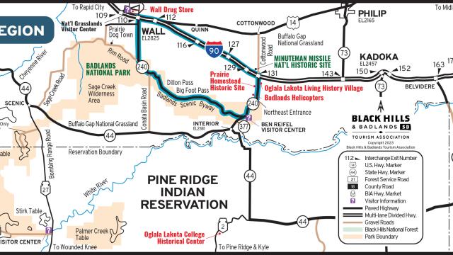
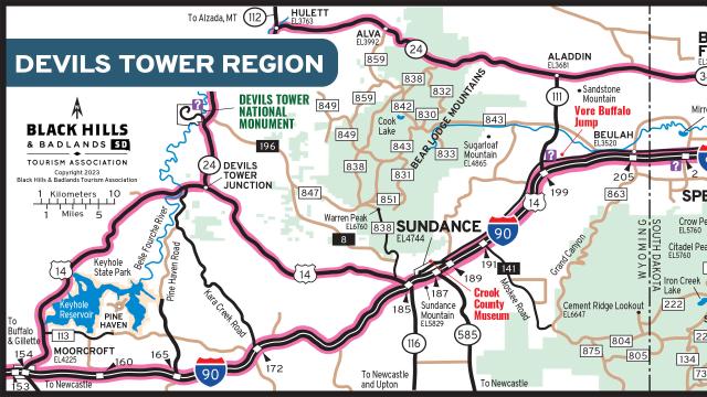
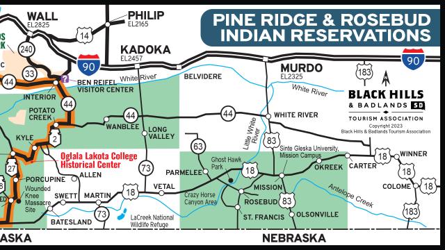
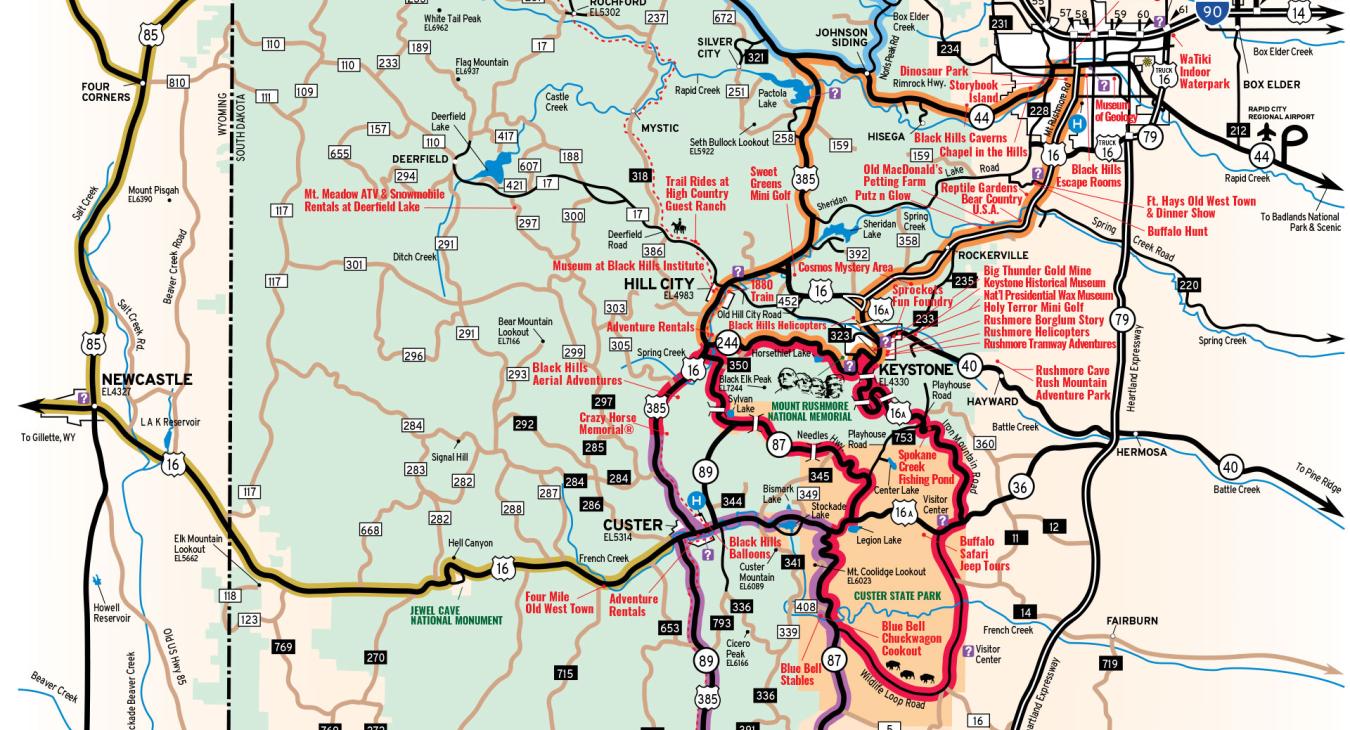
Attractions Map
The Attraction Map provides visitors with easy-to-navigate, popular driving routes and a list of regional attractions on the back of the map.
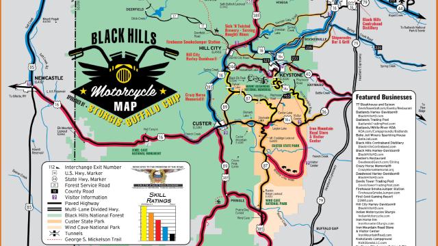
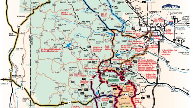
Motorcycle Map
The Motorcycle Map provides riders of all ability levels riding routes and skill ratings throughout the Black Hills and Badlands.
Route Reimagined - Highway 385
Hwy 385 will be undergoing some beneficial work in a very small section, but it doesn't mean that you can’t enjoy your vacation in the Black Hills. Check out the resources below to get started and make sure you check out the points of interest along the different routes of the Black Hills!
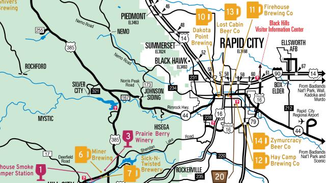
Tasting Trail Map
The Tasting Trail Map features local wineries, breweries, distilleries and tasting rooms, allowing visitors to experience handcrafted alcoholic beverages in the region.